The Confederation Bridge
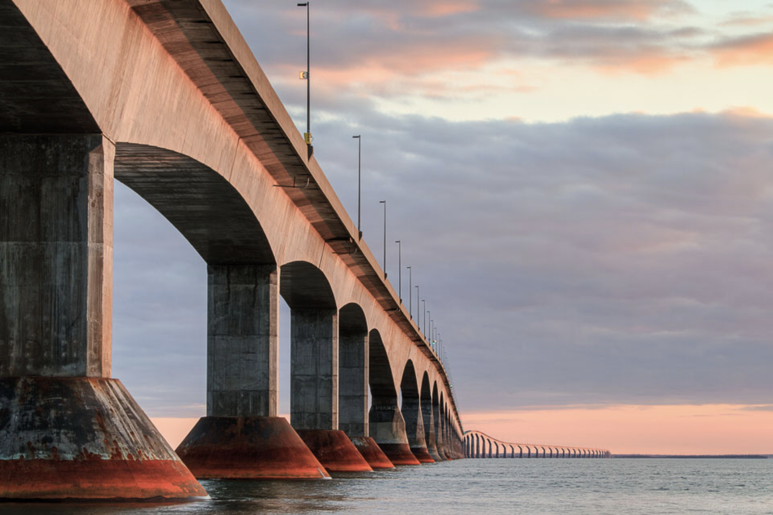
You would be hard-pressed to find many products that are designed to last for a century, let alone those that must withstand some of the harshest of environmental factors. Completed in 1997, Confederation Bridge became the longest bridge in the world crossing ice-covered seawater at 12.9 kilometers [1]. This title, however, did not come without real design challenges that had to be tackled.

Figure 1: Confederation Bridge, which spans the Northumberland Strait [2].
Confederation Bridge literally bridges the gap between New Brunswick and Prince Edward Island (PEI) in Canada. It was designed by an international engineering team led by French bridge engineer, Jean Muller, working alongside Canadian engineers from Stantec as part of the Strait Crossing Development consortium [3]. It has an estimated lifespan of over 100 years of use, owing to the high-grade concrete and reinforcing steel used in the bridge’s construction [4].
The bridge was designed with a few essential criteria to fulfill: first, the bridge needed to be high enough that sea vessels could still pass underneath. It needed to accommodate everything from ships to fishing boats, from ferries to personal watercraft, or anything that wanted to reasonably pass through the strait. Second, because of frequent icy and snowy conditions, the bridge needed to be prepared to carry an ice load on top of it as well as deal with the ice-water below it. And third, it couldn’t be too boring of a drive. That last point may sound silly, but the designers knew that a 12.9 kilometer, straight drive may lead drivers to adopt a false sense of security or doze off, causing road accidents. The danger resulting from this is only multiplied by the fact that those accidents may lead to individuals and families driving off the bridge.

Figure 2: The HMCS Ville de Quebec easily cruising underneath Confederation Bridge [5].
The first criteria was met by constructing the bridge with piers (pillars) tall enough to hold the road out of the way for vessels to pass underneath. Although most of the bridge is roughly 40 meters tall, there is a dedicated navigation span for ship traffic that is roughly 60 meters tall [4]. The piers are well-spaced to remain out of the way.
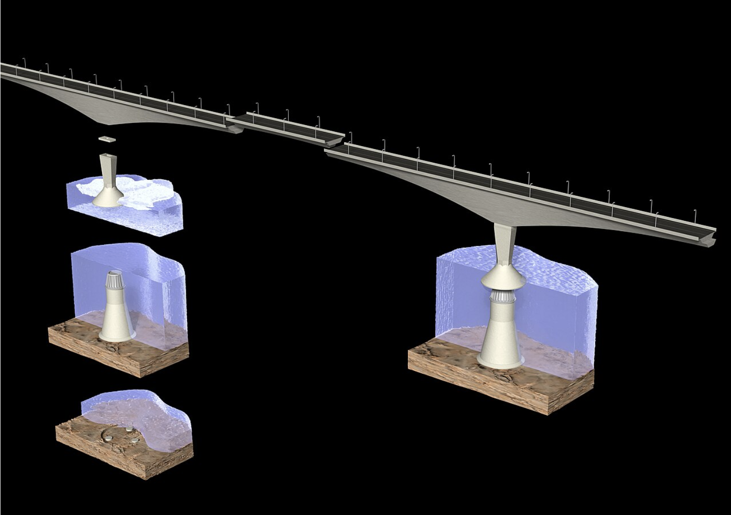
Figure 3: A diagram of the conical piers which help to break up ice [4].
The piers of the bridge were designed to have conical structures called “ice shields” which break up the sea’s ice layer as it flows into them. The idea is that oncoming sheets of ice are lifted up by the inclined surface, and the ice bends and breaks underneath its own weight [7]. Although not a new idea, it was definitely useful and necessary to include them in this project. The bridge also has over 7,000 drain ports for snow and rain to run off [3].

Figure 4: The ice cover breaking around the bridge piers [6].
Finally, the bridge was given overhead traffic lights, as well as a curved design as a safety precaution, requiring drivers to be alert at all times to make it safely to their destination [2].
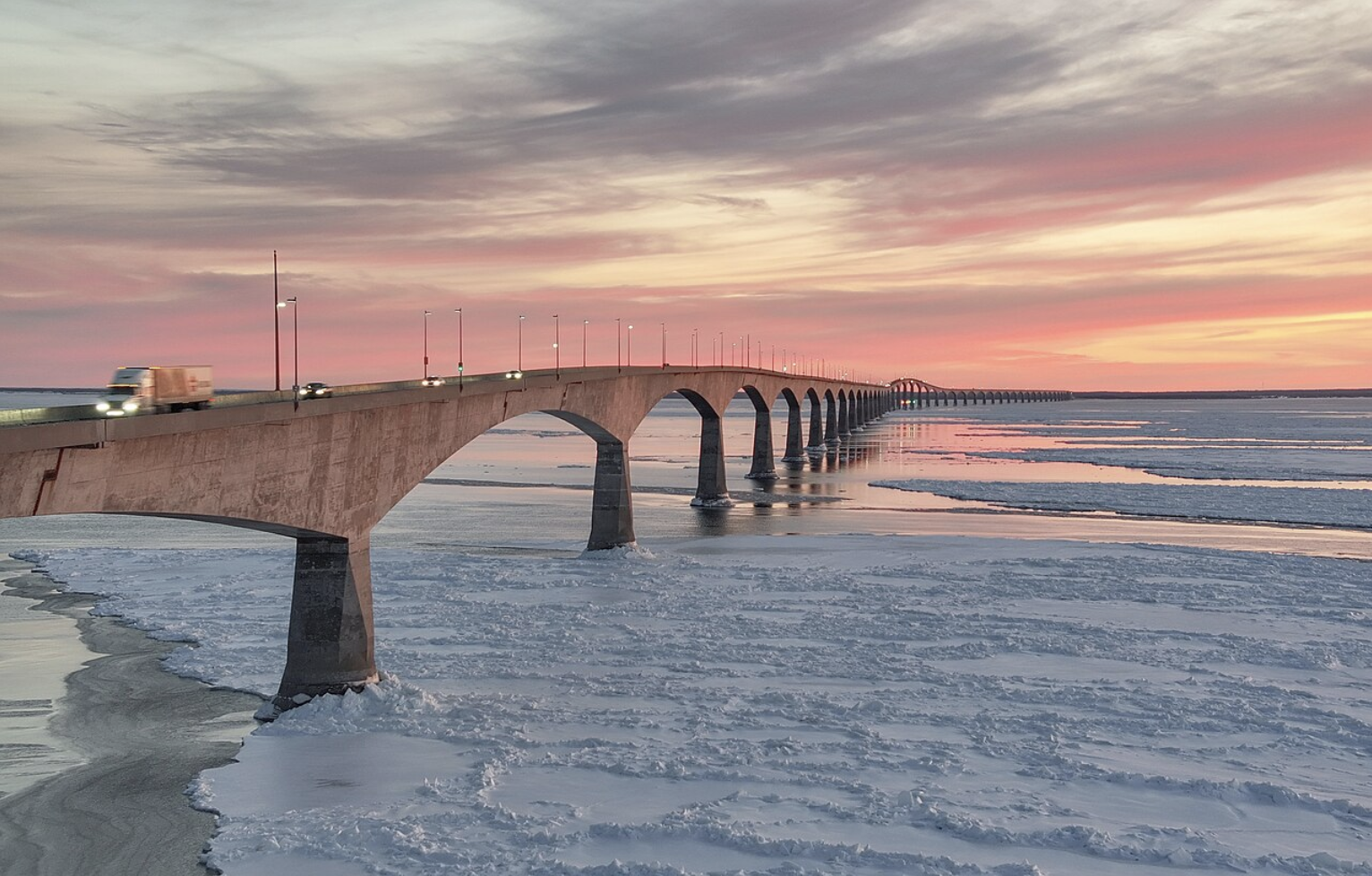
Figure 6: Confederation Bridge at sunset [4].
Confederation Bridge is an excellent example of the implementation of intelligent design principles into a practical application for daily use. It is aptly named “Confederation Bridge” in reference to the adoption of PEI into the Canadian Confederation in 1873. Canada agreed to maintain a transportation link between the island and the mainland, and this bridge helps fulfill this duty [8]. The Confederation Bridge has been said to be “a good example of the contribution by the engineering profession to the quality of life in Canada” [3].
References
[1] “About Us.” Confederation Bridge, 2026, www.confederationbridge.com/about-us/.
[2] “Confederation Bridge.” Welcome PEI, 2026, welcomepei.com/getting-here/confederation-bridge/.
[3] “The Confederation Bridge: A Promise Realized - P.E.I.’s Fixed Link Bridge to Canada.” Daily Commercial News, ConstructConnect, 21 June 2017, canada.constructconnect.com/dcn/news/projects/2017/06/the-confederation-bridge-a-promise-realized-p-e-i-s-fixed-link-bridge-to-canada.
[4] “Confederation Bridge.” Wikipedia, Wikimedia Foundation, 4 Mar. 2026, en.wikipedia.org/wiki/Confederation_Bridge.
[5] CBC PEI [@CBCPEI]. “The HMCS Ville de Quebec passing under the Confederation Bridge.” X, 20 May 2020, x.com/CBCPEI/status/1262865618295910401.
[6] “Local Scour Around Parallel Bridge Piers Under Ice-Covered Flow Conditions.” FLOW-3D Korea, flow3d.co.kr/%ec%96%bc%ec%9d%8c%ec%9c%bc%eb%a1%9c-%eb%8d%ae%ec%9d%b8-%ed%9d%90%eb%a6%84-%ec%a1%b0%ea%b1%b4%ec%97%90%ec%84%9c-%eb%b3%91%eb%a0%ac-%ea%b5%90%ea%b0%81-%ec%a3%bc%eb%b3%80%ec%9d%98-%ea%b5%ad%eb%b6%80/image-1592/.
[7] “Bridge Over Troubled Water.” Roads & Bridges, 15 Sept. 2000, www.roadsbridges.com/bridges/article/10582550/bridge-over-troubled-water.
[8] “Confederation Bridge.” Government of Canada, 5 July 2023, www.canada.ca/en/intergovernmental-affairs/services/federation/confederation-bridge.html.
To cite this article:
White, Dalton. “The Confederation Bridge.” The BYU Design Review, 11 March 2026, https://www.designreview.byu.edu/collections/alberto-santos-dumont-the-father-of-aviation.